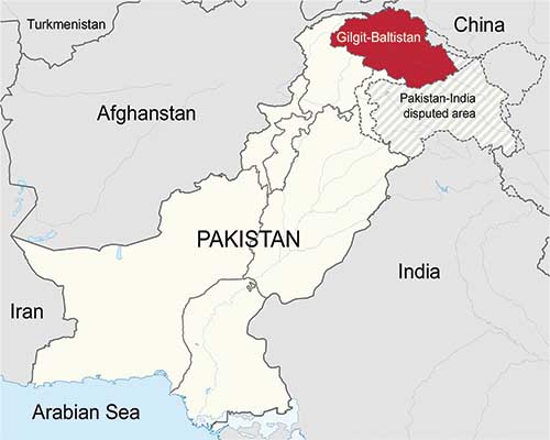
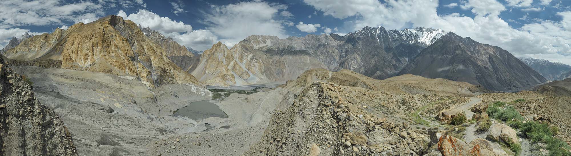
Northern Pakistan’s Gilgit-Baltistan mountainous region
A remote mountainous region in the far north of Pakistan known for high snow capped peaks, glaciers, lakes, rivers and more.
At the northern tip of Pakistan, immediately south of Afghanistan’s Wakhan Corridor and the wild frontier of China’s Xinjiang Uyghur Autonomous Region, is the autonomous territory of Gilgit-Baltistan. It lies at the confluence of three of the world’s most impressive mountain ranges: the Himalayas, the Karakoram, and the Hindu Kush. Five of the “eight-thousanders” (peaks above 8,000 m) are located here with another 50+ peaks above 7,000 m. This remote area is also known for its glaciers, turquoise lakes, and friendly people.
When we think about Pakistan, people generally have impressions of terrorism, natural disasters, poverty, and many other negative connotations. However, setting aside these, we may also have visions of natural beauty, friendly people, tasty food, colourful festivals, lasting traditions, and many more.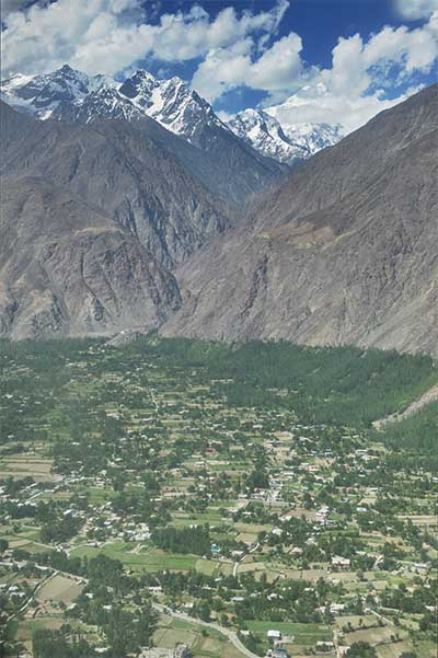
I recently planned a trip to northern Iraq. Due to increased insurgence in the area, I decided to change direction to northern Pakistan. I figured that Pakistan is relatively safer than northern Iraq at the time. While much of Pakistan is not necessarily safe at any time, I decided to let the good triumph over the bad, so I embarked on my Pakistan excursion.
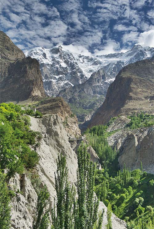
While Pakistan is a very diverse country with great natural beauty, it is the mountainous region in the north which has always captured my imagination. At the confluence of three mountain ranges, the Himalayas, the Karakoram, and the Hindu Kush, lies Pakistan’s northernmost region – the autonomous territory of Gilgit-Baltistan.
To the north-northwest of Gilgit-Baltistan lies a small portion of Afghanistan’s Wakhan Corridor “pan-handle”. Tajikistan is just a short hop north across the Wakhan Corridor. To the north-northeast is the wild frontier of China’s Xinjiang Uyghur Autonomous Region. The Indian-administered Jammu and Kashmir borders to the southeast and further south lies the Pakistani-administered state of Azad Jammu and Kashmir. Geographically this region is untamed, remote, and perfectly suited for the intrepid traveller!
MOUNTAINS
Gilgit-Baltistan is best known as the home of many of the world’s highest mountain peaks. Five of the “eight-thousanders” (peaks above 8,000 m) are located in the region, with another 50+ peaks above 7,000 m. The planet’s second highest peak, K2 (Mount Godwin-Austen), is located here, while the most feared peak among mountaineers, Nanga Parbat, is also in the region. The main mountain ranges are the Karakoram and the western Himalayas. Further north along Afghanistan’s Wakhan Corridor and Tajikistan lie the Pamir Mountains, while the Hindu Kush lies to the northwest along the Afghanistan border. The highest peaks, such as Nanga Parbat (8,126 m), are to the east along the western Himalayas in the Skardu District. Other high peaks are K2 (8,611 m), the Gasherbrums (7,932 – 8,080 m), and Masherbrum (7,821 m).
GLACIERS
Minapin Glacier at Rakaposhi Base Camp, Hunza Valley
In addition to the majestic snow capped peaks dotting the landscape of Gilgit-Baltistan, the region is also known for its spectacular glaciers. In fact, three of the world’s longest glaciers outside the North and South Polar regions can be found in Gilgit-Baltistan: the Biafo Glacier (67 km), the Baltoro Glacier (63 km), and the Batura Glacier (57 km).
The International Centre for Integrated Mountain Development (ICIMOD) estimates that Pakistan is home to around 5,218 glaciers with a total cover area of about 15,000 sq km. Most of the glaciers are located in the Karakorum Mountain range with almost 37% of the area being under glacial ice. Siachen Glacier (76 km), the world’s second longest glacier, is located in Indian claimed territory and runs along the disputed India-Pakistan line of control in the eastern Karakoram range.
The glacier’s altitude ranges from as high as 5,753 m at its head at Indira Col and down to 3,620 m in the lower reaches at the China border. The world’s third longest glacier, the Biafo Glacier, also lies in the Karakoram range. And the list goes on with many more of the world’s greatest and longest glaciers located across the region. These glaciers are enormous sources of fresh water. The melting glaciers feed fresh water to more than 60 large and small rivers in Pakistan. As the glaciers are retreating due to climatic changes and global warming, their beauty won’t be around forever! Some conservative estimates are that these glaciers will retreat by another 40-60 meter over the next decade.
GLACIAL LAKES
Looking to swim in a glacial lake? Pakistan is the place! It is estimated that Gilgit-Baltistan is home to more than 2,000 glacial lakes – many that have not been explored. Some of the most impressive high-altitude lakes are located in the eastern Skardu area: Sheosar Lake, Satpara Tso Lake, Katzura Tso Lake, and Phoroq Tso Lake. Also, Biafo Glacier (the world’s third longest at 67 km) meets the Hispar Glacier (49 km) at the famous Snow Lake at a height of 5,128 m. This created the world’s longest glaciated highway (100 km) which stretches from Askole in the Shigar Valley all the way to Hispar in the Nagar Valley of Gilgit Baltistan.
PETROGLYPHS
Interested in ancient rock art and petroglyphs? Gilgit Baltistan has it and some are very easily accessible from the famous Karakoram Highway (KKH). Some geologists estimate more than50,000 pieces of petroglyphs and rock inscriptions are dotted along the KKH in theGilgit-Baltistan region. Most are concentrated at ten major sites along the 280 km route between Shatial in the south and the Hunza Valley to the north. Created by pilgrims, traders, invaders and locals alike, some of the earliest carvings date back to between 5000 BC and 1000 BC. Likely carved with stone tools, the carvings include drawings of humans, animals, and people hunting animals.
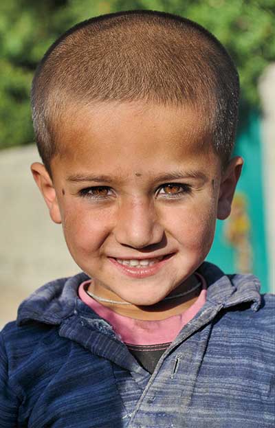
Boy in Gulmit Village in the Upper Hunza Valley
PEOPLE
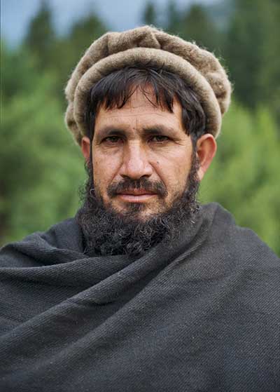
The total population of the Gilgit-Baltistan region is over two million souls. Due to the historic isolation of valleys separated by inaccessible mountains, the region developed people that are very diverse linguistically, ethnically and adhering to many religious sects. The main religious groups include the Shias (35%), Sunnies (35%), Ismailis (25%), and the Noorbakhshia (5%). The ethnic groups include the Shins, Burushos, Yashkuns, Kashmiris, Kashgaris, Pamiris, Pathans, and the Indus Kohistanis. Most people in the region speak Urdu which is the lingua franca of the region. Other common languages are Balti, Shina, Burushaski, Khowar, Wakhi, and to a lesser extent, Punjabi, Pashto, Kashmiri Domaaki and Gojri.
DESERT
Gilgit-Baltistan is home to the Skardu Desert which is known as the world’s highest and coldest desert where winter temperatures can dip down to -25C! At an altitude of more than 3,000 m, few people venture into this remote area. It has been described as “a desert surrounded by a valley that is covered with lush green vegetation where you can walk around a green paradise which suddenly meets a barren desert from where you can see the snow-capped mountain peaks towering high above miles of sand dunes”.
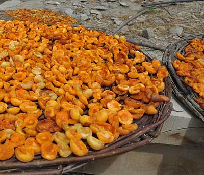
Drying apricots in Minapin Village, Hunza Valley
FRUITS
Gilgit-Baltistan produces about 75% of Pakistan’s apricots, while cherries, apples and plums are in abundance. Other seasonal fruits grown are succulent dates, mangos, peaches, blue berries, as well as water and honey melons.
FESTIVALS
As polo is the most popular sport in Gilgit-Baltistan, one of the best festivals to attend is the annual three day “Polo on the Roof of the World” (also known as the “Shandur Polo Festival of Pakistan”) held during the second week of July.
The matches are played in the town of Skandur Top between the home teams of Gilgit and Chitral as well as teams from other regions. Situated at 3,719 m, it is the highest, and likely the most remote, polo grounds in the world. The polo festival also includes local folk music and dancing. Accommodation is available in a temporary camping village. However, for those of us more interested in colourful folky festivals with an abundance of photo opportunities, head 360 km west to the town of Chitral near the border with Afghanistan.
The town of Chitral is located in the Khyber-Pakhtunkhwa province immediately west of Gilgit-Baltistan. The Kalash people, a Dardic indigenous group of the Indo-Iranian branch, speak the Kalasha language and are adherents of Islam and their own Kalash religion. The Kalash people are known for their festivals adjourned with colourful dressed beautiful women. The four main festivals of the Kalash are the Joshi festival (May), the Phoo and Uchau festivals (autumn), and the Chawmos festival (midwinter).
Gilgit, gateway to the far north
The capital of the Gilgit-Baltistan region is the town of Gilgit, which is the largest town on the Karakoram Highway before reaching the China border.
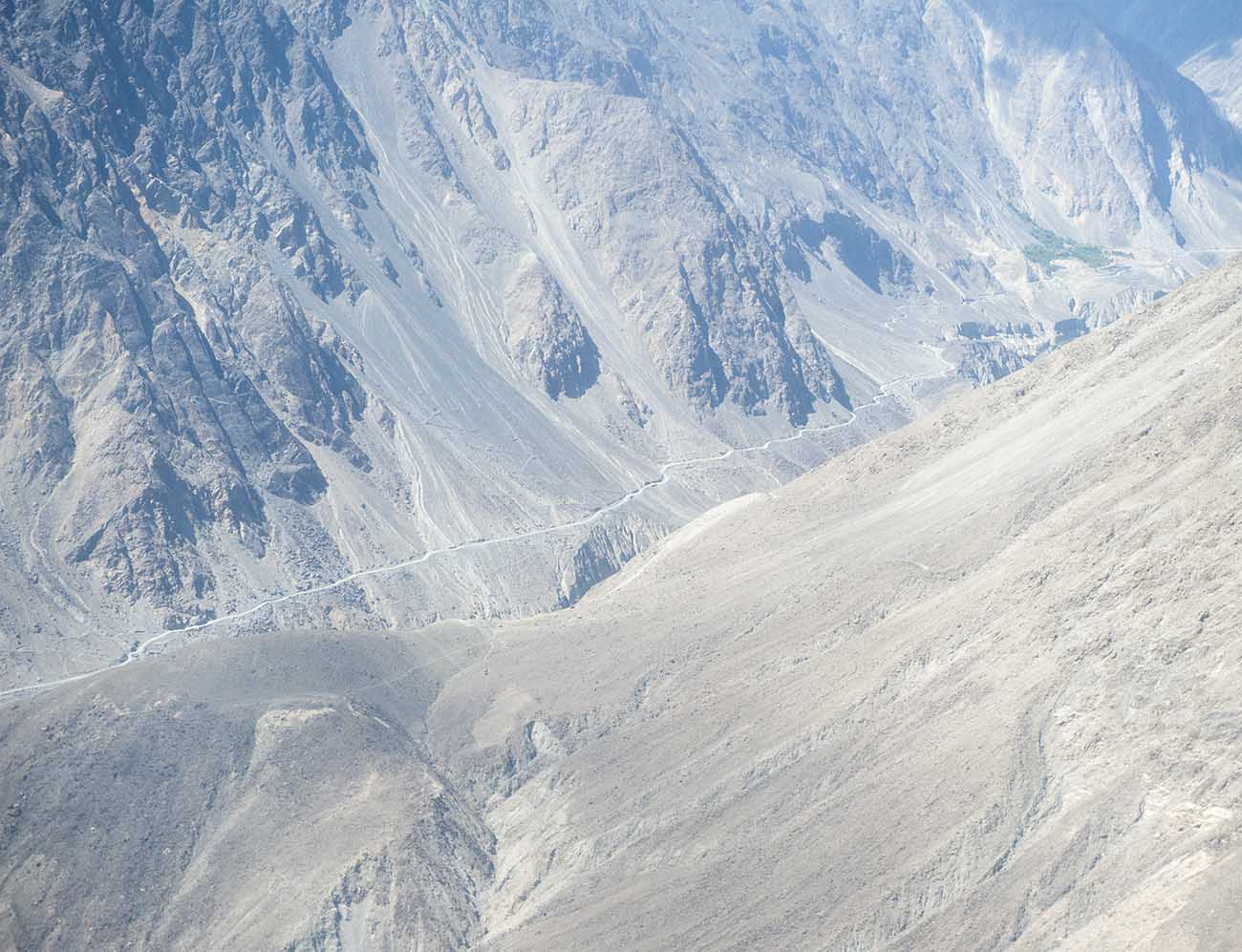
Approaching Gilgit on the flight from Islamabad
While a private vehicle from Pakistan’s capital, Islamabad, can make the journey north to Gilgit via the Karakoram Highway in about 15 hours (12 hours via Naran in the Kaghan Valley), public buses take about 18 hours as they leave Islamabad throughout the afternoon and arrive mid-morning on the next day.
By far the most convenient, yet always risky of last-minute cancellation, is the hour-long flight on Pakistan International Airways (PIA). PIA usually has two scheduled flights per day, departing in the early morning, on a French-Italian manufactured ATR 42 twin-turboprop aircraft.
Due to extreme weather changes in the north, flight delays or even cancellations are a normal and frequent occurrence. No wonder there have been no serious accidents and incidents on this ATR 42 aircraft route.
The town of Gilgit is situated along the Gilgit River and is surrounded by stunning mountain scenery. Giltgit makes an excellent central base from where to arrange trips in all directions: to the north lies the Hunza Valley; to the east and southeast is the Central Karakoram National Park which includes the beauty around Skardu; to the south lies the Deosai National Park and the lush Kaghan Valley; and, to the west is the Shandur National Park.
Venturing further west, beyond the boundaries of Gilgit-Baltistan, is the Chitral District of the Khyber-Pakhtunkhwa province with its colourful Kalash people.
Therefore, it makes perfect sense to use Gilgit as a base from where to explore the entire northern areas of Pakistan.
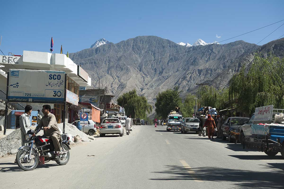
North of Gilgit towards the Hunza Valley
Hotels in Gilgit are plentiful and several local attractions are worth visiting, such as the Gilgit Bridge over the Gilgit River and the authentic bazaars. A few attractions outside town can be visited on day trips, such as the Kargah Buddha (a rock engraving of Buddha from the 7th century AD), the monument of Taj Mughal, the Naltar Valley, and many interesting one or two-day trekking routes.
A few weeks or months before arriving in Gilgit, get in touch with one of the most experienced and professional guides of the Gilgit-Baltistan region. Nasir Ahmed has been a resident of Gilgit for many years and knows the entire area very well. He specialises in personally taking out individuals or small groups into any direction.
Nasir is well connected in the region to arrange anything and everything that trekkers of all expertise require. If he is not available to do personal guiding at any specific time, he will arrange for a friend to stand in for him. However, he will still be involved in the planning of the trip. (See end of the article for his contact details).
Lower Hunza Valley
Rakaposhi Peak, Lower Hunza Valley
The Karakoram Highway to the northeast follows the flow of the Gilgit River through the Nagar Valley in the Karakoram Mountains where it is called the Hunza River.
Just over an hour of scenic driving along this route passes the small town of Ghulmat. Stop just before the small bridge from where to get the best views of Rakaposhi Peak on a clear day.
Rakaposhi, meaning “Snow Covered”, ranks as the 27th highest mountain peak in the world and 12th highest in Pakistan. However, what places Rakaposhi at the top of its class, is its sheer slopes.
With its summit at 7,788 m above sea level, it has an unbroken slope and almost straight vertical rise of 5,838 m from where the bridge is located at 1,950 m above sea level. Looking up at a mountain slope almost 6 km higher from where you stand is a surreal experience!
Starting in 1938, a number of attempts have been made to conquer Rakaposhi’s summit. After a few unsuccessful attempts, the first success came in 1958 when a British-American expedition led by Mike Banks and Tom Patey reached the summit via the south-west ridge. Since then, less than half of all attempts to reach the summit have been successful.
Another 7 km north of Ghulmat lies the small quaint village of Minapin Nagar.
Minapin Village, Hunza Valley
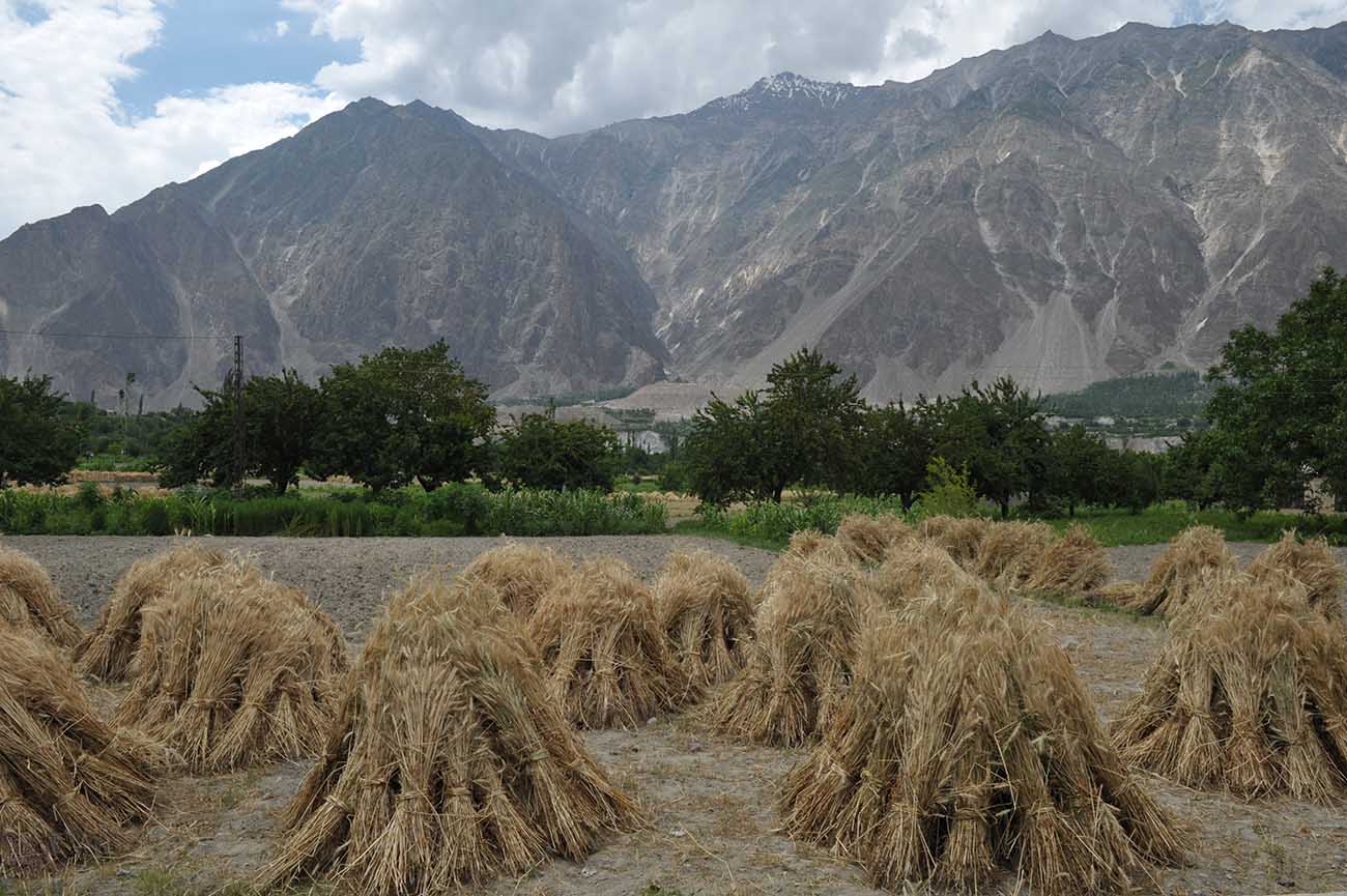
In season (June/July), the succulent apricots and cherries are ripe, while the families work on the paddies to bring in the rice harvest.
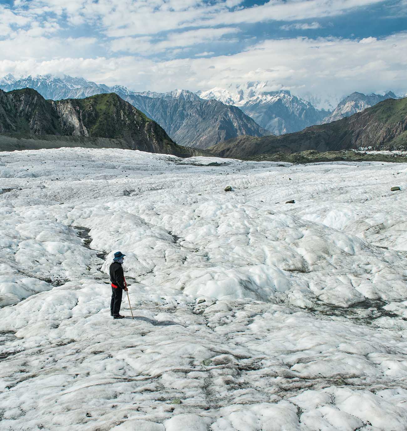
Book in at the Diran Guest House and enjoy the fruits in the garden. Walk around the village and mingle with the rather reserved residents. Have a good night’s sleep but rise early and leave the hotel at 5 am for the 5.5-hour hike up to Minapin Glacier.
Minapin Glacier lies at about 3,440 m above sea level while the Diran Guest House is at about 2,000 m. This leaves a 1.6 km vertical hike over a 5.5 hour period.
For the first two hours of hiking the ascent is quite vertical and tough. The hiking trail is steep and passes some beautiful grassy areas from where the views of the Hunza Valley are absolutely stunning. You will pass several goats and their keepers who bring their animals up into the mountains during the summer months. They will stay here and sleep in rustic old shacks before returning to the village before the arrival of the harsh winter. After about 4 hours of hiking, the lower foot of the glacier comes into view. The upper section of the foot is bright white and where it leaves the main glacier the ice-peaks jut out high above the crevasses.
Minapin Glacier at Rakaposhi Base Camp
The last hour of hiking goes along a small hiking trail up the hill next to the massive glacier. Soon the Rakaposhi-Diran ridge line comes into sight as you arrive at the massive Minapin theatre surrounded by some of the highest peaks in the world: Rakaposhi (7,788 m), Diran (7,257 m), Hachindar Chish (7,163 m), and Ultar Peak (7,329 m).
Stop. Put down your hiking stick and backpack. Sit down and take a well-deserved rest. Gaze out over this vast theatre of a massive glacier surrounded by several towering snow-capped peaks. Listen to the river of crystal clear water running above and under the glacier. Listen to the cracking of the glacial ice. Often you will hear thunder coming from large pieces of ice breaking off the peaks and plunging down onto the glacier. Imprint this moment into your mind because you need to recall this memory file many times during the rest of your life. However, you may just want to sit here for the rest of your life, but you can’t, so pick up your backpack and hiking stick and keep moving.
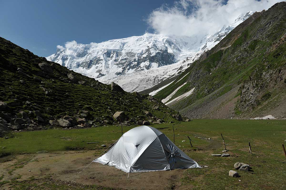
Set up your lonely tent next to Minapin Glacier at Rakaposhi Peak
Once you arrive on the lush green mini plateau right next to the glacier, and in the shadows of the majestic Rakaposhi, set up your tent and take a well-deserved rest. Your guide and cook will immediately start the fire to warm up a lovely soup with freshly baked bread from the village.
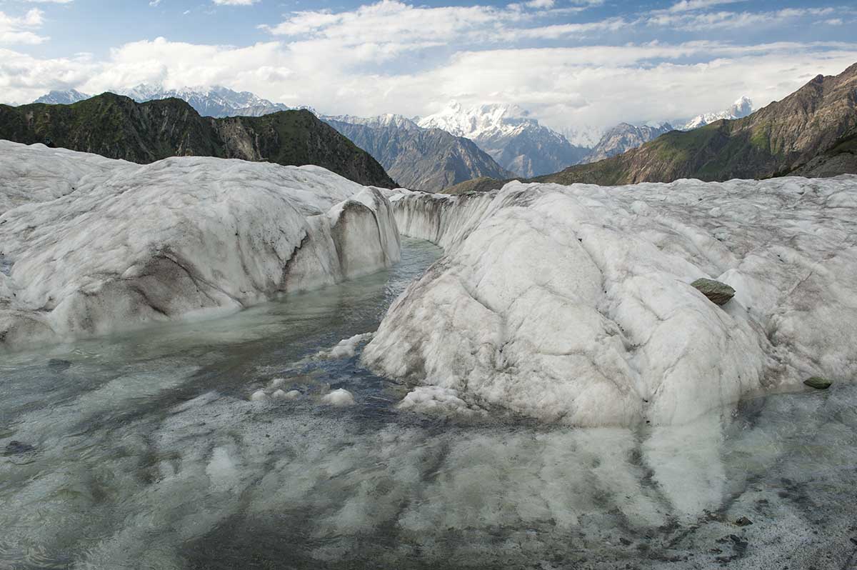
After lunch, stay close to your guide as you explore this massive glacier. You will walk all over the glacier in all directions but never leave the side of your guide as the last thing you want is to slip and slide down a deep crevasse. In summer and autumn, the melting glacier creates mini rivers of water flowing on the surface.
Further down towards the foot of the glacier the surface rivers divert to flow under the glacier and then into a larger stream which eventually flows into the Hunza River down at the Hunza Valley. At night you most likely will be awakened by the sound of cracking glacier ice or even by the thunder of avalanches and falling chunks of ice.
Spend a night or two and then return by the same route back to Minapin Nagar village.
Central Hunza Valley
Views of Ultar Peak from the Al Barakaat Hotel in Karimabad
From Minapin Nagar the road towards the north passes Murtazaabad village before entering the Central Hunza Valley, which stretches roughly from Murtazaabad in the south, up north to Attabad where the “new Attabad Lake” wall is.
This part of the Hunza Valley is mainly inhabited by the Burusho people who speak their Burushaski language. While today the original Burushaski language remains fairly intact, a non-speaker can pick up loanwords from English, Urdu, Persian, and from the neighbouring Dardic languages such as Shina and Khowar.
The main town in the Central Hunza Valley is Karimabad, which is about an hour drive north of Minapin Nagar. From here several high peaks are visible. Most impressive are Rakaposhi (7,788 m), Ultar Sar (7,388 m), Diran Peak (7,266 m), Bublimating-Ladyfinger Peak (6,000 m), and Spantik (7,027 m) which is also known as Golden Peak.
Karimabad is also home to the ancient Baltit Fort with a community known as the ‘Domaki’ people who live in the immediate vicinity called ‘Mominabad’.
The Baltic Fort was founded in the 1st century and has been on the UNESCO World Heritage List since 2004. While the foundations of the fort date back more than 700 years, it has been rebuilt and altered numerous times over the years.
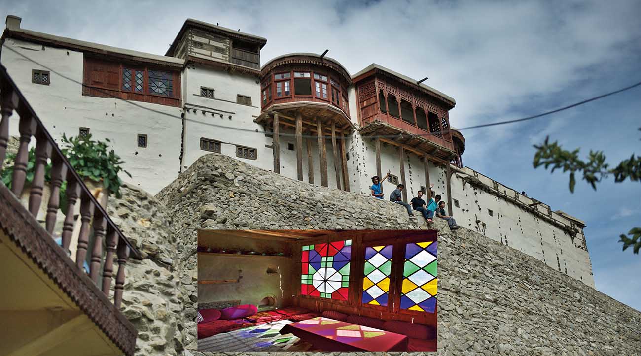
Baltit Fort, Karimabad
During the 16th century, the new bride of the local prince brought in craftsmen to renovate it in a Balti style which clearly shows strong Buddhist Tibetan influences.
The last occupant of the fort was the ‘Mir of Hunza’ – the ruler of the Hunza Valley. He moved his family out in 1945.
With the initiative of the Royal Geographical Society of London and with the financial support of the Aga Khan Trust for Culture Historic Cities Support Programme, extensive renovations were completed in 1996.
The fort is now a lovely museum with some very interesting guides.
The current Aga Khan (a name used by the Imam of the Nizari Ismailis since 1818) is His Highness Aga Khan IV (78). As one of the world’s ten richest royals, the Aga Khan Trust is very actively involved in development projects in Africa, Asia, and the Middle East. It’s been reported that the Trust allocates about US$600 million per year to philanthropy.
The views from the Baltic Fort of the Hunza Valley are impressive! Book into Karimabad’s Al Barkat Hotel where most balconies have great views of the valley and peaks.
This is cherry and apricot heaven, so if you are here in July you will have ample fruits to eat.
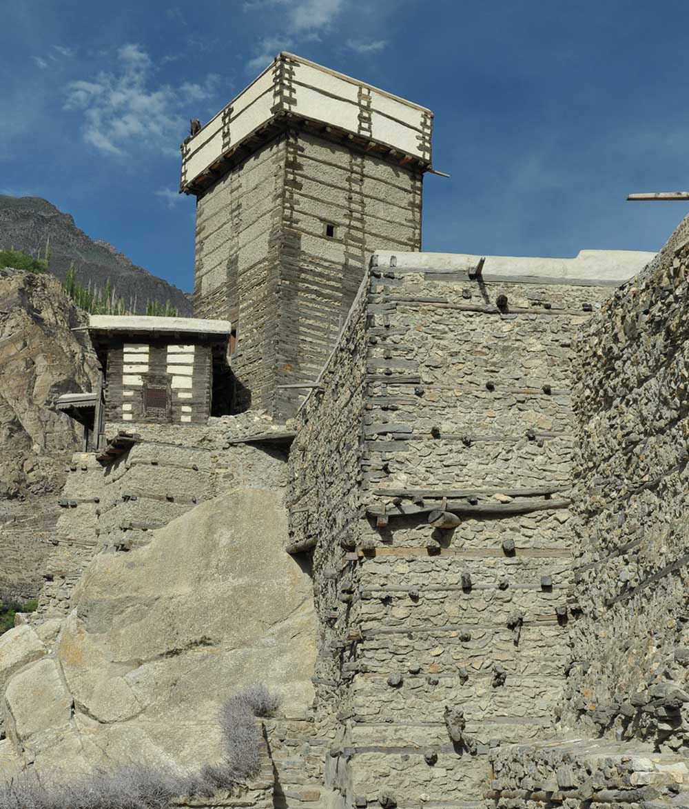
Altit Fort in Altit Village near Karimabad
Just about 3 km southeast of the Baltit Fort along the banks of the Hunza River is the village of Altit, famous for the Altit Fort. Altit is the birthplace of the Hunza Kingdom and Altit Fort is the oldest fort still standing in all of Gilgit-Baltistan. Built on a sheer rock-cliff that falls 300 m into the Hunza River, the fort was the original home of the Mir of Hunza before the family moved to the somewhat newer Baltit Fort. With its sharp drop-off into the river, the fort was not only highly defensible against enemies from outside, but was apparently also ideal to get rid of enemies from within!
The Altit Fort with it’s imposing tower is estimated to be between 800 and 1,100 years old, which makes it about 50 to 100 years older than the nearby Baltit Fort.
The Aga Khan Trust and the Government of Norway financially supported recent renovations which were completed in 2007. The quaint village around the base of the fort has been upgraded with financial support from the Japanese Government.
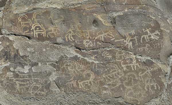
The Haldeikish Sacred Rocks Petroglyphs of Hunza
Back on the Karakoram Highway, on the west banks of the Hunza River close to Karimabad, are the Sacred Rocks of Hunza. Located at a place called Haldeikish are some of the many carved rocks of the Hunza Valley. Many of the inscriptions on the rocks are carved in the Kharosthi language and include names of Buddhist pilgrims and merchants. It also shows a portrait of a Kushan king in Central Asian dress with the name “Gondophernes” written in Kharosthi.
Other inscriptions are written in Sogdian, Brahmi, Sarada and Proto Sarada languages. Names of emperors appear, as well as drawings of local life including people and animals.
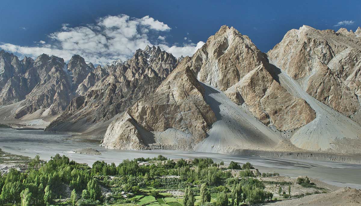
Upper Hunza Valley – Gojal Valley
Commonly referred to as the Gojal Valley, the upper Hunza Valley stretches from the new Attabad Lake all the way north to the Khunjerab Pass on the border with China’s Xinjiang Uyghur Autonomous Region.
Around Borith Lake near Passu Glacier, north of Gulmit Village
A forty minute drive north of Karimabad, in the southern section the Gojal Valley, is Attabad Lake.
This new lake was naturally created just a few years ago. On January 4 in 2010, a massive landslide at Attabad village killed twenty people and blocked the flow of the Hunza River for the next five months.
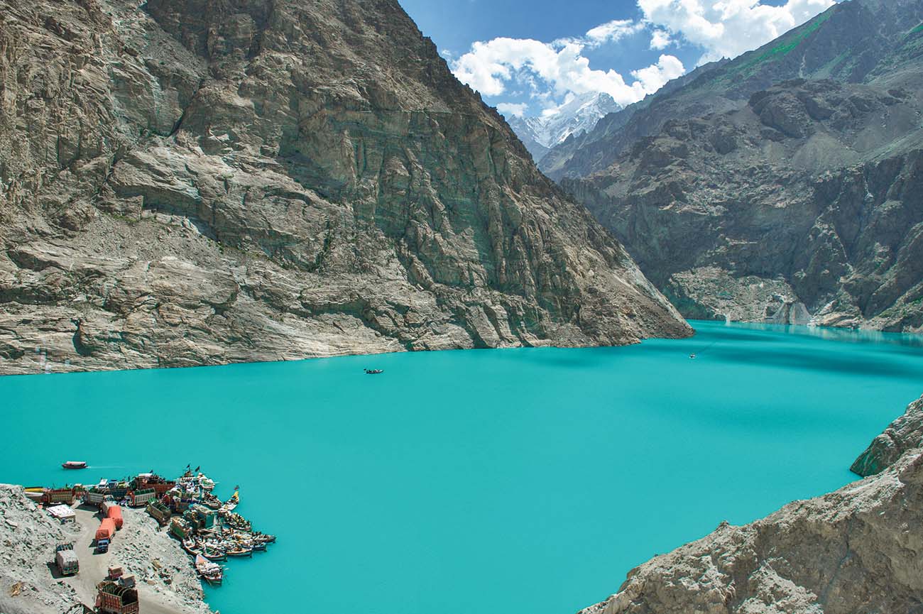
Southern End of Attabad Lake
The flooding displaced about 6,000 Wakhi and Burushaski speaking minority ethnic people from upstream villages. Thousands were stranded without any land transportation as the flooding inundated over 19 km of the Karakoram Highway. The lake reached a length of 21 km and a depth of over 100 m by June 2010. By the time the new lake reached its peak, about 240 houses, 135 shops, four hotels, two schools, four factories, and several hundred acres of agricultural land had been submerged.
At the time of writing (July 2015), which is five and a half years since the landslide, the Karakoram Highway still terminates at the landslide point from where all people and goods are loaded onto small rickety boats for the 45 min trip up to the northern tip of the lake near the village of Gulmit.
From here the Karakoram Highway continues all the way up to the China border.
With the help of the Chinese government, a series of road tunnels around the lake are being constructed. The new road is expected to open by the end of 2015.
The Karakoram Highway will forever be submerged at the bottom of the lake, unless the landslide-wall breaks, which will be a major catastrophe for everything downstream, even down to Islamabad in the far south!
Gulmit at the northern tip of the lake is the administrative headquarters and is a centuries-old historic town surrounded by mountain peaks, glaciers, rivers and lakes.
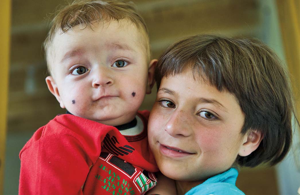
People at Gulmit Village in the Upper Hunza Valley north of the Attabad Lake
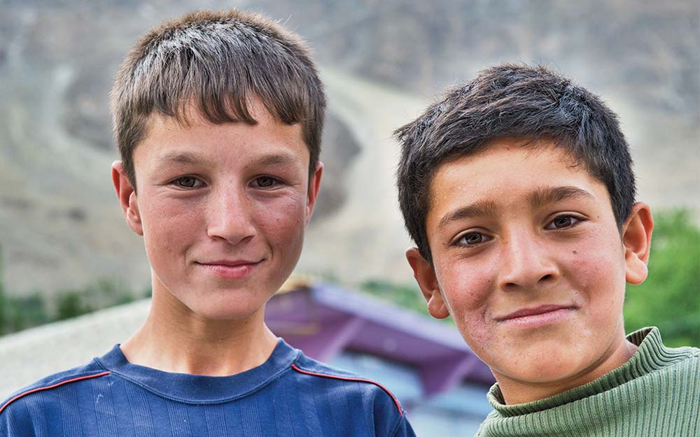
The boys around Gulmit Village
Many of the area’s residents are immigrants from Central Asia, most notably Tajikistan to the north which explains why most people in this part of Gilgit-Baltistan are Wakhi-speakers and followers of the Ismaili sect of Shia Islam. The Wakhi language has its origin in today’s Wakhan Corridor of Afghanistan where it is still spoken. In additional to be spoken in the Wakhan Corridor and in the Gulmit area, it is also spoken in Tajikistan’s Gorno-Badkhshan area immediately north of the Wahkan Corridor, and by Tajiks living in China’s Xinjiang region.
The people of Gulmit are fair skinned with many having light brown hair and even blue and green eyes. In additional to being beautiful people, they are also incredibly friendly. It won’t take long before you are invited into their modest homes where you will sit on their beautiful carpets and have tea with freshly baked flatbread.
Drop in at the “Korgah Old House Weaving” house to experience a really old house and to see several ladies weaving carpets. Many of the residents are well educated but job opportunities are limited, so they have to find work in the larger cities around Pakistan.
Further north of Gulmit are the small communities of Ghulkin, Passu, and a few others up to the border with China.
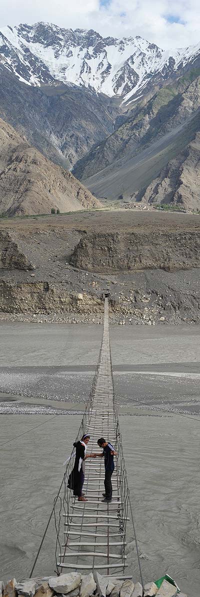
The Passu Hanging Footbridge
About 15 km north of Gulmit along the Karakoram Highway lies Passu, famous for its glaciers (Passu, Borith, Batura and Pamir), lakes (Borith and Shimshal) and mountain peaks.
Some of the notable peaks include Batura (7,785 m), Shisper (7,611 m), Passu (7,284 m), and the most remarkable Mount Tupopdon (6,500 m). Inspired by its unique structural attributes, Mount Tupopdon is also referred to as Passu Cathedral.
Passu Cathedral Peak, South of Passu Glacier, north of Gulmit Village
A small road up to the left of the Karakoram Highway leads to the foot of Passu Glacier. Walk high above the glacier further up the hill to have spectacular views of the glacier and the valley surrounded by majestic peaks.
Back to the Karakoram Highway, hike down to the Hunza River which in late summer will be a small stream meandering across a very wide riverbed.
Walk along the riverbed to the Passu Hanging Footbridge (2,400 m) which spans 200 m across the river. Go ahead and walk on the bridge, aptly labelled “The World’s Most Dangerous Bridge”. Walk all the way like the locals do. You will never forget this crossing!
The scenery around this area is truly unforgettable.
Fairy Meadows
One of the most exciting destinations in the Gilgit-Baltistan region is the Fairy Meadows, locally known as Joot.
However, the real excitement is not so much the end destination, but the journey to get there.
About 78 km south of the town of Gilgit is the famous Raikot Bridge (1,100 m) over the Indus River. On the east side of the river banks, just across the bridge, is a small settlement with an aptly named Shangri La Hotel. At PKR 2,000 (US$20) per night for a double room it is quite a good deal, though the restaurant is basic with food and drinks being limited and over-priced.
This is the gateway to the basecamp of Nanga Parbat (8,126 m) and Fairy Meadows (3,300 m).
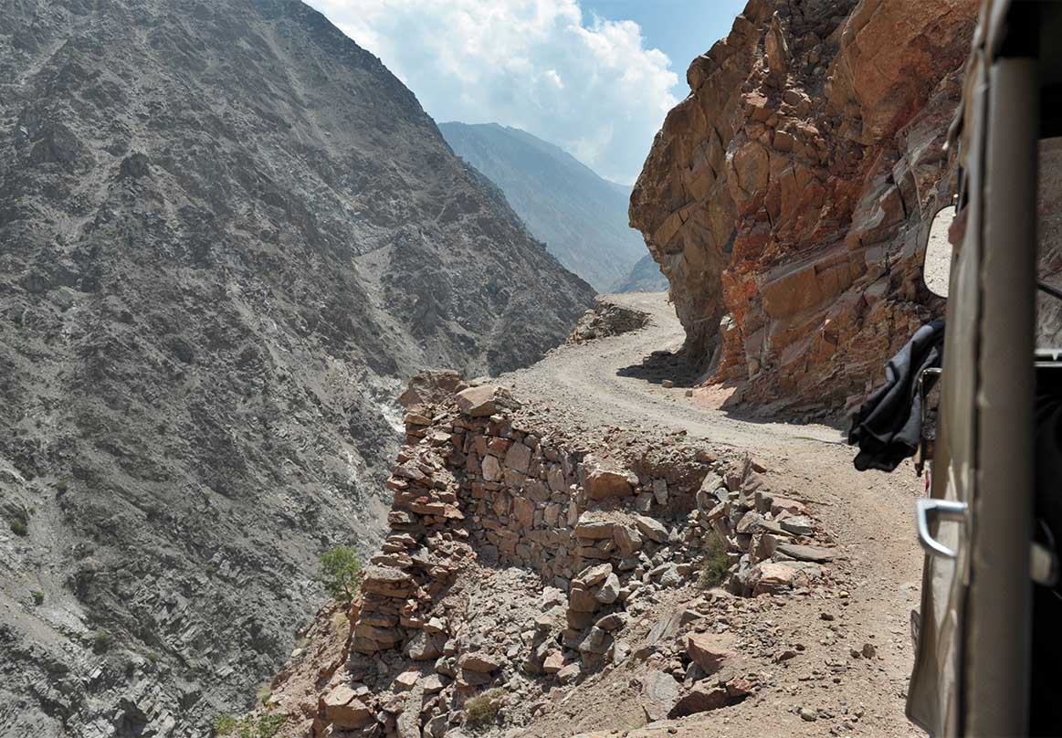
Along the Landrover path from Raikot Bridge to Fairy Meadows
Negotiate a fare with one of the many small jeeps for the approximate one hour drive (12 km) on one of the scariest roads in the world.
This is truly one of the scariest and most dangerous roads in the world.
According to guides and local drivers, accidents are rare. However, landslides are quite frequent which sometimes wash away large sections of this small road which is precariously built with loose rocks along the steep mountains.
This is not an experience for the faint-hearted.
The jeep trip terminates near the village of Tato, across a 6 m deep gorge and stream with no bridge. Carefully walk down the gorge, cross the stream by walking over the make-shift log, head up the gorge and into the small settlement.
From here it is another three to four hours (5 km) of steep hiking along the small path up to the lush green mini-plateau referred to as the Fairy Meadows. In total, the altitude climb from Raikot Bridge to Fairy Meadows is about 2,200 m.
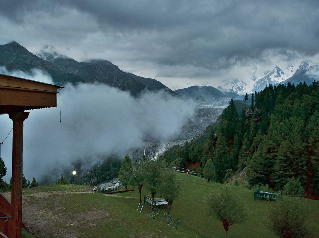
Around Fairy Meadows with a view over Raikot Glacier
Fairy Meadows has a small community of rather unfriendly and camera-shy residents.
A resident at Fairy Meadows
The community benefits financially from the visiting tourists who spend about PKR 17 million mainly on food, transportation and accommodation. Don’t even take a photo in the general direction of someone, or even the village, and you will hear wild screams of “No photo!” These people are so out of character with that of the Gilgit-Baltistan people who are very friendly and welcoming.
The “resort camp” at Fairy Meadows is referred to as Raikot Serai and has a couple of fairly basic huts for rent, as well as ample space to set up a tent. Some of them have open views of the Raikot Glacier and the north face of Nanga Parbat, commonly referred to as the “Raikot Face”.
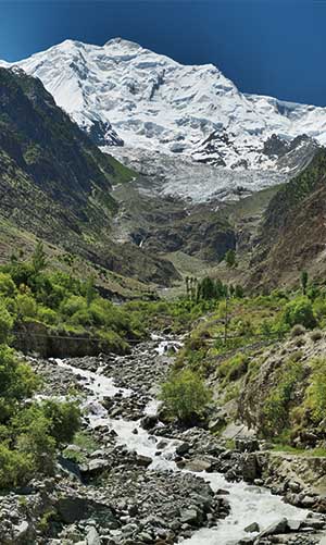
Hike up north of the village, all along the right side of Raikot Glacier which originates from Nanga Parbat peak.
After about an hour of hiking through lush forests, you will arrive at the foot of Nanga Parbat. From here, on a clear day, the views of the mountains and glaciers are stunning. Nanga Parbat, also referred to as “Killer Mountain”, is the ninth highest mountain on earth and the second highest in Pakistan.
There is so much to explore in the Gilgit-Baltistan region that a few months are required. It is not uncommon among some trekkers to spend two or three months in the region. If money and time is not an issue, head up to Gilgit-Baltistan for one of the most incredible trips of your life!
This article appears in the July 2015 issue of Globerovers Magazine.
![]()
View magazine HERE
Purchase magazine HERE
More photos of Pakistan’s Hunza Valley HERE
